Home Resources About Contact
Structures constructed by man such as dams, building, bridges, etc are subject to loads which can deform the structure and
can lead to failure. A deformation survey is a survey to determine if a
structure or object is changing shape or moving. The three-dimensional
positions of specific points on an object are determined, a period of time is
allowed to pass, these positions are then re-measured and calculated, and a
comparison between the two sets of positions is made. Deformation surveys are
performed at periodic intervals to monitor the stability of structures and to
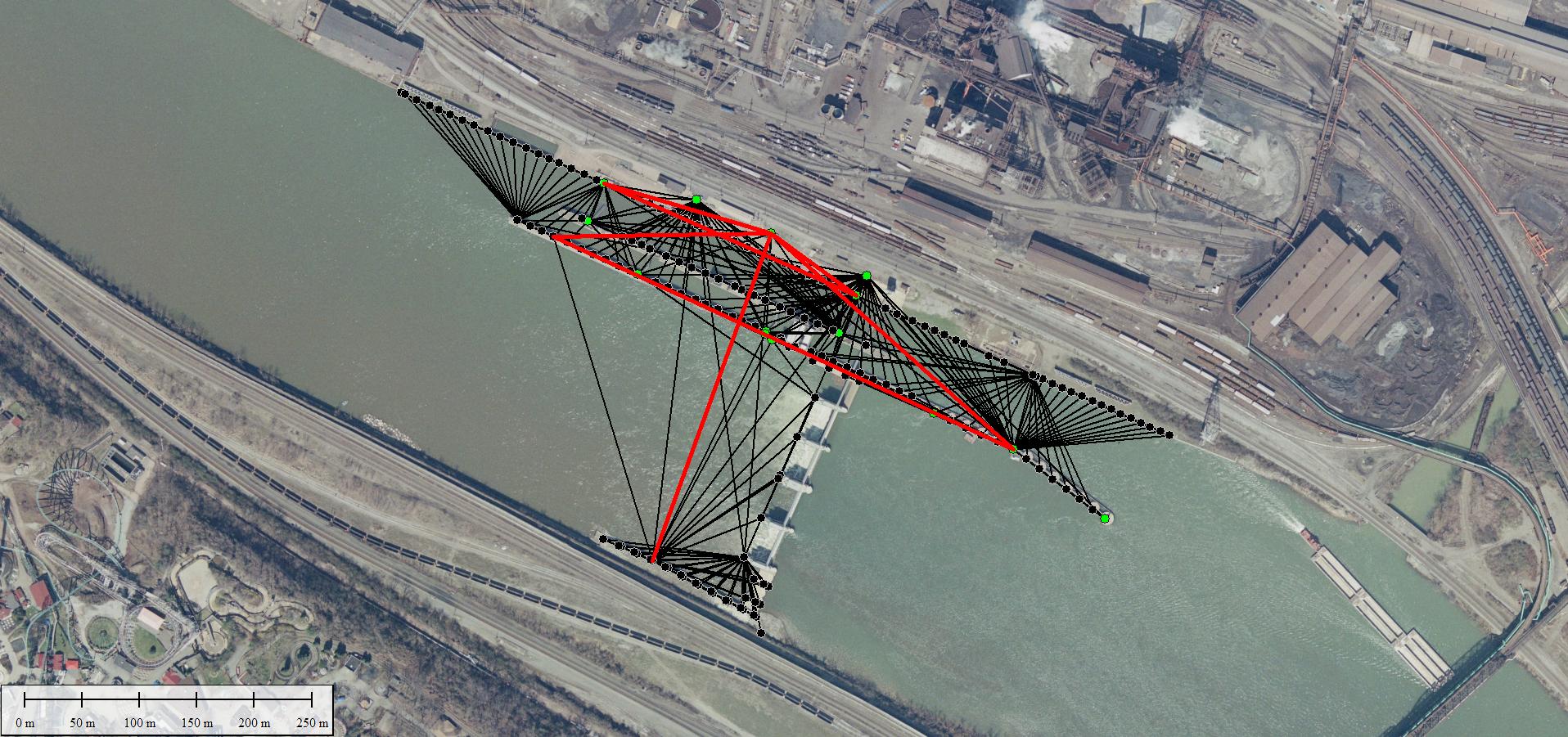
give early warning of any unexpected behavior. Terrasurv has performed more
than 350 deformation surveys on more than 40 locks and dams operated by the US
Army Corps of Engineers. These surveys are custom designed for each structure
to best monitor potential movements and take into account
the type of structure (concrete, earthfill) as well as the past history of
each. A typical monitoring project consists of a
site visit to determine existing conditions and to plan the network. Pre-Analysis of each structure is preformed
using the simulation function in least squares programs to design the most
economical network which meets project specifications. Typical design
accuracies are ±3 mm for concrete structures and ±1 cm for earthen dams. This
information is then used in the office to plan a scheme of observations that
will meet the required accuracy. Next, the field observations are performed.
This data is then processed and adjusted in the office to yield data that can
be used as a baseline for future observations or to compare against previous
surveys.
Another type of deformation survey is the monitoring of ground
subsidence above mining operations, such as salt and coal mines. These surveys
are done using a combination of precise leveling, high accuracy
traverse/triangulation, and GNSS Surveys.
Example Project: Braddock Locks and Dam: